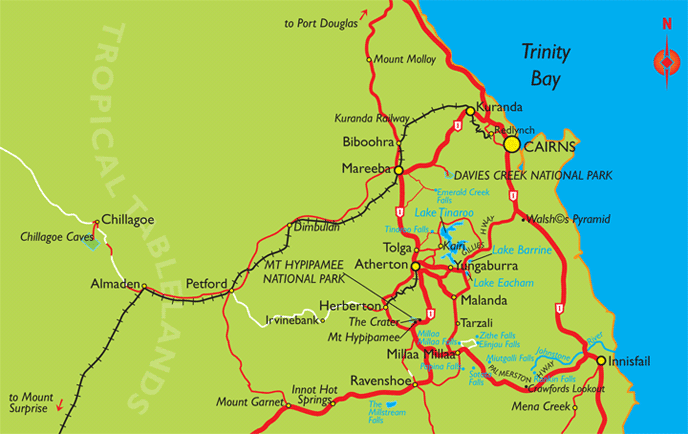
Cairns Region Map including Atherton Tablelands
The Cairns region is diverse, with the Atherton Tablelands sitting on the Great Dividing Range forming the western boundary of the city and the Great Barrier Reef to the east. The closest main town south is Innisfail.
Atherton Tablelands locations include Kuranda, Biboohra, Mareeba, Tolga, Atherton, Yungaburra, Malanda, Millaa Millaa, Ravenshoe, Herberton and Mount Garnet.
There are a wide range of national parks and lakes in the area, including Emerald Creek Falls, Lake Tinaroo, Lake Barrine, Lake Eacham, Millaa Millaa Falls, Zithe Falls, Elinjau Falls and the Millstream Falls.
Cairns Region Map, Queensland Tourism
This map is not to be reproduced outside Queensland Tourism guidelines. e-CBD is not able to give permission to reproduce this map.