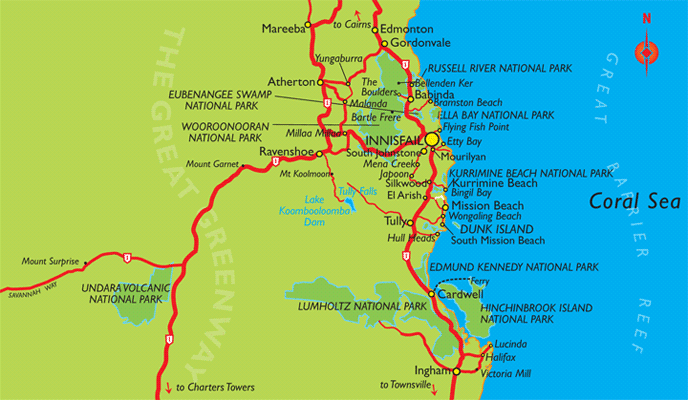
Innisfail Map
Innisfail is located about 1600km north of Brisbane and about 90km south of Cairns, on the Queensland Coast.
There are many national parks located around Innisfail, including Russel River National Park, Ella Bay National Park, Eubenangee Swamp National Park, Wooroonooran National Park, Kurrimine Beach National Park, Edmund Kennedy National Park, Hinchinbrook Island National Park, Lumholtz National Park and Undara Volcanic National Park.
A number of small towns and localities surround Innisfail, with Edmonton, Gordonvale and Babinda to the north on the way to Cairns, Mareeba, Atheron and Ravenshoe in the mountains to the north-west and to the south lie Silkwood, El Arish, Tully, Cardwell and Ingham.
The Great Barrier Reef lies just off the Queensland coast with the beaches of Bramston Beach, Kurrimine Beach, Mission Beach and Dunk Island close by.

Innisfail Map, Queensland Tourism
This map is not to be reproduced outside Queensland Tourism guidelines. e-CBD is not able to give permission to reproduce this map.
