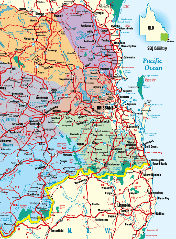
Southeast Queensland Highways Map
South East Queensland is the area of Queensland extending from the New South Wales border in the south, to Gympie in the north, and west from the coastline to Dalby. Highways link all the major centres.
Major cities and towns in this area include Brisbane (the state's capital city) and Ipswich, the Sunshine Coast including Caloundra, Maroochydore, Mooloolaba and Noosa, then south of Brisbane lies the Gold Coast. West of here lies the Darling Downs main centre, Toowoomba. South of Toowoomba are the Granite Belt towns of Warwick and Stanthorpe. The Golden West encompasses towns west of Toowoomba and include Pittsworth, Oakey, Dalby and Millmerran.
North of this region lies the towns of Nanango, Kingaroy then back towards the coast is Kilcoy, Woodford, Caboolture and the Sunshine Coast hinterland villages of Maleny, Montville, and Mapleton. North from here is Yandina, Cooroy, Kenilworth and Gympie.

Southeast Queensland Highways Map, Queensland Tourism
This map is not to be reproduced outside Queensland Tourism guidelines. e-CBD is not able to give permission to reproduce this map.
